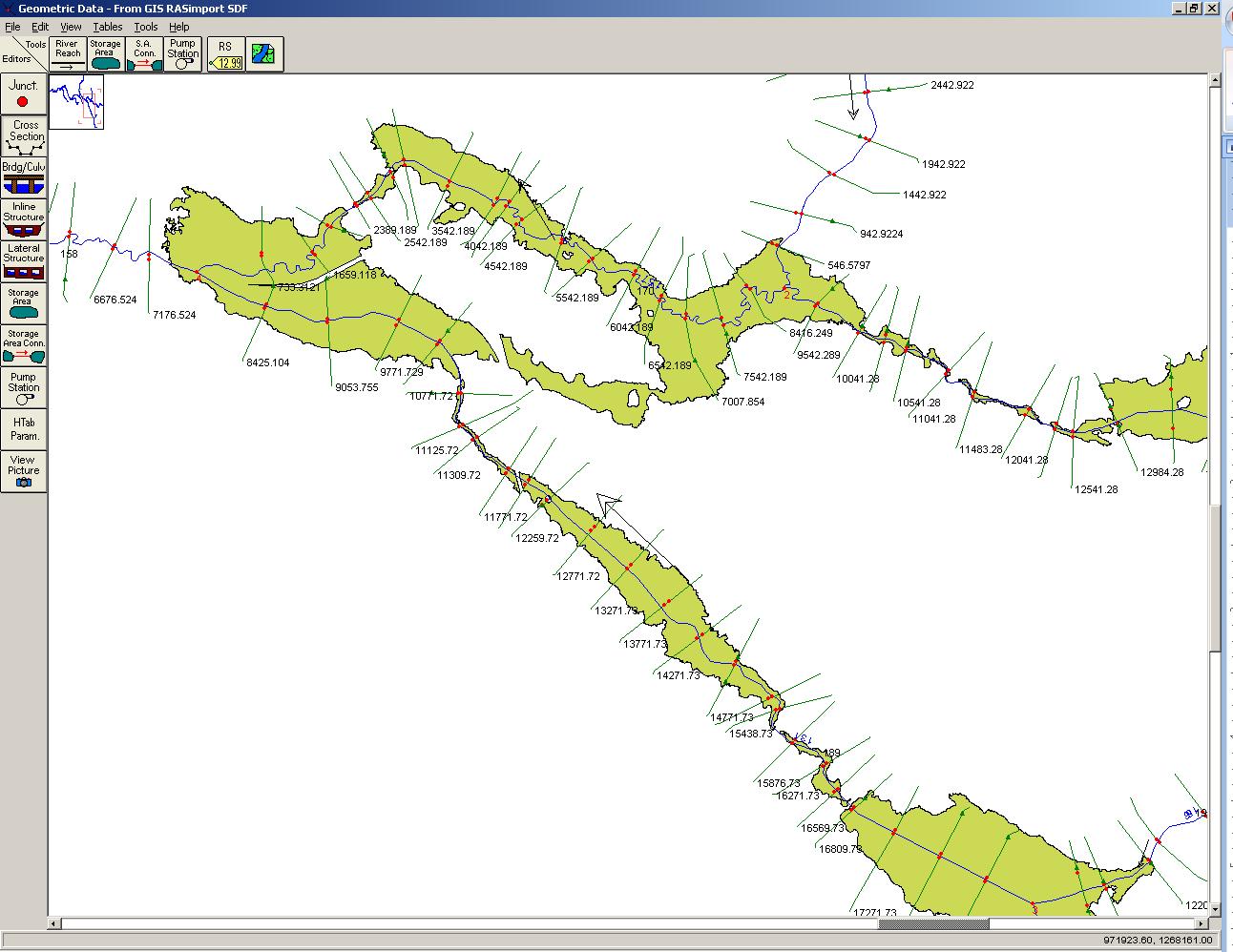
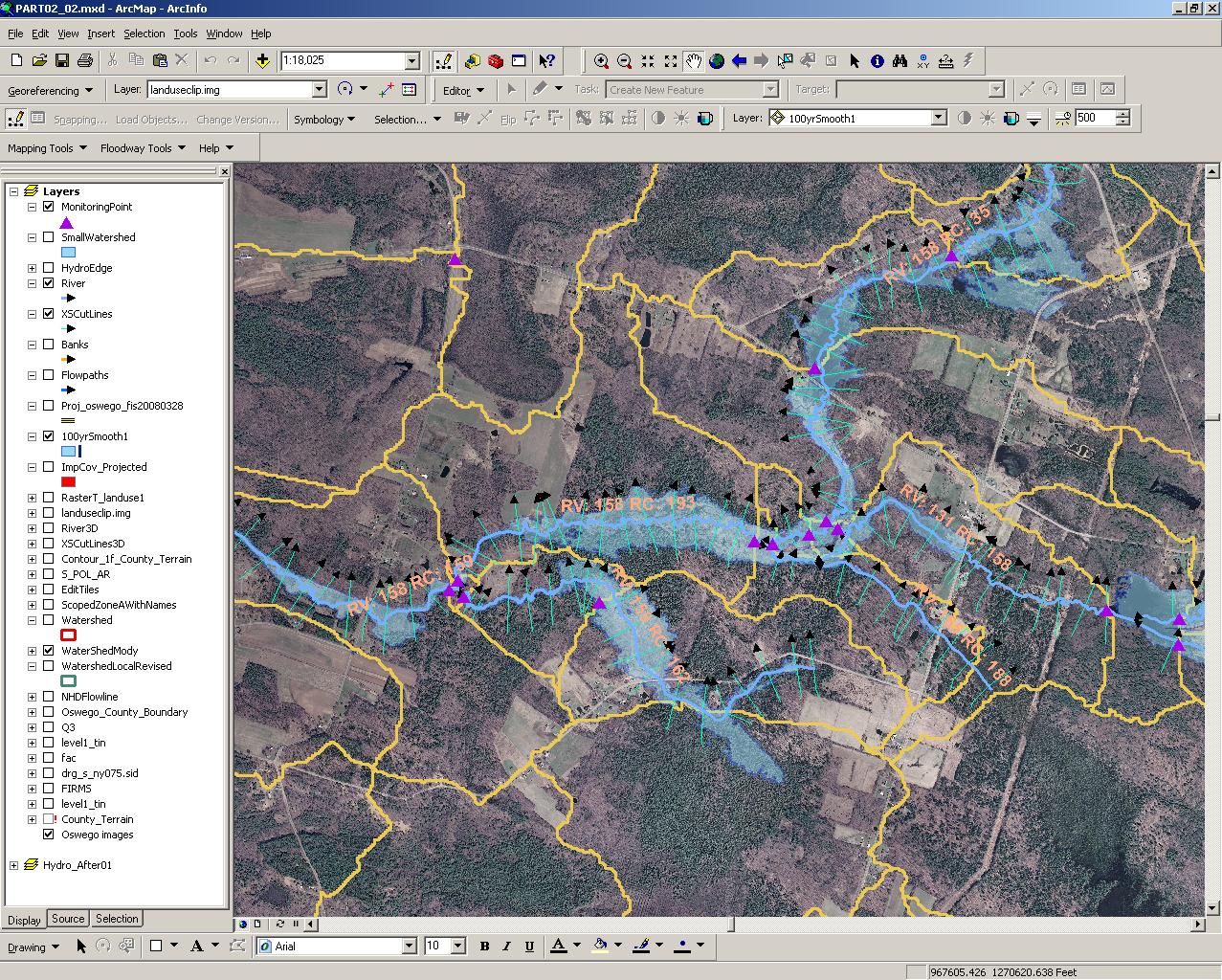
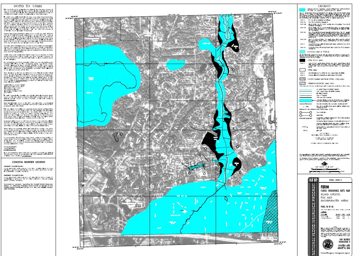
The following flood insurance study projects involved hydrologic and hydraulic analyses of all the major waterways within each community listed. Each project incorporated HEC river modeling, and hydrologic analyses to compute the 10-, 50-, 100- and 500- year discharges. Hydraulic profiles for each design storm were derived and floodplain and floodway boundaries were mapped. Most projects included aerial photogrammetry, field surveys, and mapping of the study areas. A study report for each community was prepared.